The neighbourhood
Surfers Paradise by street, starting at QT's front door
Opinionated and local in tone, factual in content. Distances from Google Maps and OpenStreetMap; history from Wikipedia unless we say otherwise.
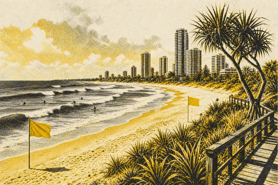
North Surfers: Staghorn, Cypress and the beach
QT sits in the stretch of Surfers Paradise north of the main mall, a grid of short avenues running between the Gold Coast Highway and the Esplanade. Staghorn Avenue and Cypress Avenue are the two streets you will use most: Staghorn for the hotel, Cypress for the tram stop that Google Maps sends you to. The Esplanade along the beach is the road to walk at sunrise. Surfers Paradise Beach runs the whole length of the suburb as one continuous sand beach, and the hotel says it is 50 metres from its door.
Our opinion on this part of town: it is the best compromise in Surfers. You are close enough to the centre to walk there and back in under half an hour, and you are not sleeping above the bars of Orchid Avenue.
Cavill Avenue and the centre
Cavill Avenue is twelve minutes' walk south of QT, 850 metres by Google Maps. It is named after Jim Cavill, whose Surfers Paradise Hotel of 1925 gave the suburb its name, and between the beach and Orchid Avenue it is a pedestrian mall (Wikipedia). Wikipedia describes the area around Cavill, Orchid and Elkhorn Avenues as the busiest part of the suburb and the Gold Coast's nightlife precinct. It is where Schoolies gathers each year in late November and early December, with a supervised event zone on the beach. If you are booking for the last week of November, expect crowds.
Things to look for: the Kinkabool on Hanlan Street, the first high-rise in Surfers (1959, ten storeys, still standing), and the heritage-listed Matey Memorial, a 1957 bronze of a homeless dog in Cavill Park. The beachfront foreshore was rebuilt in 2011 with about 95 pandanus trees kept or added. SkyPoint, the observation deck on levels 77 and 78 of the Q1 tower, is 230 metres up; Q1 is 322.5 metres tall and opened in 2005.
The river side: Budds Beach, Chevron Island, HOTA
Walk west from the highway and Surfers turns into a river town. Budds Beach is a small sandy beach on the Nerang River facing Macintosh, Chevron and Cronin Islands, named after Alan Foster Budd, who built a house there in the 1940s. Chevron Island is a residential island connected by Thomas Drive bridges. Across the river, Evandale Park holds the council chambers and HOTA, Home of the Arts, the city's cultural precinct with a gallery that opened in 2021, an outdoor stage and a bridge to Chevron Island. All of this is from Wikipedia.
Our tip: if you are staying more than two nights, give one late afternoon to the river side. It is quieter than the beach and the light is on your face as the sun sets.
South along the tram line
The L1 tram heads south from Cavill Avenue through Northcliffe and Florida Gardens to Broadbeach North, the stop for The Star. Broadbeach is 4.3 km south-south-east of Surfers by Wikipedia's reckoning, and has its own beach, restaurants and the Pacific Fair shopping centre at Broadbeach South. Since August 2026 the tram continues through Mermaid Beach, Nobby Beach and Miami to Burleigh Heads, where the headland national park has a rainforest climb and an ocean-view track. See our dispatch on the tram to Burleigh.
North to Main Beach and The Spit
North of QT the tram runs through Surfers Paradise North and Main Beach towards Southport. Sea World sits on The Spit, the sand peninsula north of Main Beach; it began as the Surfers Paradise Ski Gardens and moved to The Spit in 1971 (Wikipedia). Warner Bros. Movie World (opened 1991) and Dreamworld are further north near the M1 and are easiest by car or tour bus. QT's concierge handles e-bike hire, according to the hotel; ask there about getting to the parks.
Further out: the hinterland
Behind the coast, Springbrook and Lamington National Parks are part of the Gondwana Rainforests of Australia World Heritage Area. Lamington is about 85 km south-west of Southport (Wikipedia). You need a car or a tour. Our hinterland dispatch covers what to plan.